Campsite 8 has the best views of both the Tularosa Basin and the mountains near Sierra Blanca. I was glad to see it was empty, and even had a beautiful example of New Mexico's state flower, Aluminum budlightium var. NFL.

Here is the view to the east. The high point has no name that I know of. Hiding behind it is Lookout Mountain. The campground is in the piñon-juniper zone, but the hikes all head uphill to intersect with the Crest Trail, so you climb into the pine-oak belt and the fir-aspen belt, and finally up to the spruce-fir belt. The trails climb an average of 1,000 feet in elevation for every mile travelled.

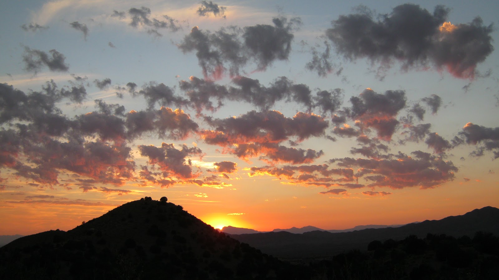
The same view at sunset.

Looking west, in the direction of the Tularosa Basin.
There's nothing better than enjoying sunset by a campfire.


My first day hike was up the Dry Canyon trail. Before you start the climb, you cross Three Rivers canyon. The river would just be a creek anywhere but in the Southwest. Anything that flows year-round deserves to be called a river here.

As you start the climb out of the campground, the view of the Tularosa Basin opens up. The little strip of white in the distance on the left is the northern edge of White Sands. It was a hazy day, and warm for October.

At the lower elevations, there is a lot of Prickly Pear cactus. The tunas were ripening and there was a lot of evidence along the trail that the local bear and raccoon populations were feeding heavily on them. Tunas are pretty tasty.

By the time you get into Dry Canyon proper, the views close in. I didn't take many photos at that point, mainly because I was just concentrating on putting one foot in front of the other. Katie-the-collie and I didn't make it all the way to the Crest Trail. We did a 6.5 mile round trip with an almost 3,000 foot elevation gain. I'm not in the greatest shape, but I guess I'm a little more fit now than I was before this hike. We climbed quite a ways past the rock outcropping in the following photo.

Along the way, in the pine-oak zone, I saw a lot of this plant. I think it is a variety of White Clematis, but don't know for sure. Any experts out there who can confirm this identification?

After making my way back down the canyon, there was time for dinner, a refreshing beverage and a small campfire before bed. I slept well. Being tired will do that - or maybe it was the beverage.
Dry canyon is the one at the left side of the following photo taken from the campground. You can also see that the aspens are reaching their peak color in the heights. Weather permitting, I will be up at the higher elevations of the wilderness in about a week. I hope the aspens will hold their color until then.

The next day Katie and I took a less strenuous hike on the Barber Ridge trail. This trail runs north along the edge of the wilderness for a while before turning east to climb up to the Crest trail. We only did the north-south section as far as Goat Canyon. The further out you go, the less developed the trail, and some sections are pretty rocky. It amazes me that horses can get through some of these trails, but obviously they do. The part of the trail we were on stayed in the piñon-juniper zone.

Another view toward the "Tulie" Basin, with White Sands off in the distance.

Along the way, a Rainbow Grasshopper posed for a picture. She was about two inches long.

A nice place where Katie and I stopped for a snack.

We arrived back at camp in the afternoon, in time to listen to the Giants game on internet radio. There were cell towers off in the distance on a ridge, and I was amused that I had much better cell signal at the campground than I get at home. I'm guessing that the towers mainly serve the military installations out in the basin. I don't think they would be placed there for a few ranchers and campers, but who knows?
The last time I was at Three Rivers CG, I had just adopted Katie and it was her first camping and hiking trip. Every time we went by the empty campsite we stayed at then, Katie stopped and wanted to investigate. I swear she remembered the area and the previous trip. That was quite a while ago, too.
The next day it was time to head home to take care of some chores. The round-trip only took about seven gallons of gas, yet it was far enough away that I had the feeling of being "elsewhere". Three Rivers made for a nice little autumn getaway.
No comments:
Post a Comment