Thursday, September 27, 2012

Jack's Creek Campground and the Pecos Wilderness

I had many reasons to head to the upper Pecos: fall colors, full moon, hiking trails into the wilderness and trout. As a bonus, the Pecos River and wilderness are less than one tank of gas from home. Plus, this area was recommended by Argonaut20 over on WanderTheWest. So, on September 27 I headed to Jack's Creek campground to make that my base camp for a few days of exploring. The campground is at the north end of the road that goes up the Pecos Canyon and has trailheads that take you into the Pecos Wilderness.  Even on a Thursday afternoon the campground was about one-third full. I picked a site at the end of the upper loop that offered the most seclusion, and settled in.


The fall colors were not yet at their peak around Jack's Creek.

I hadn't had a chance to camp around full moon in several years. Full moon is less useful time for the astronomy projects I worked on, but it is valuable engineering time, and I always had to be on hand to organize the night-time engineering activities. So, this night I enjoyed being free to watch the moon peek out from behind the clouds that brought a few light rain showers. Unfortunately, my point-and-click camera  could not capture the moonlit landscape.

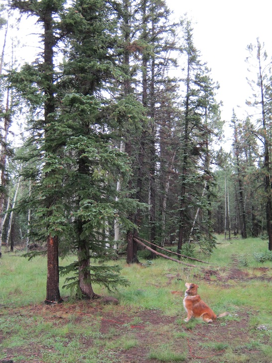
After a good night's sleep and a leisurely bacon and egg breakfast, Katie-the-collie and I headed down the trail to the Pecos River. We poked around, investigating various pools, and generally enjoying the day. We made it a little way into the wilderness, following the river, until brewing afternoon thunderstorms made us turn back to camp. This trail is a bear highway, based on the amount of scat I saw. I didn't take the fly rod for this hike, but planned to return the day after next.

The Pecos River

A decapitated old puffball along the way

A nice rock outcropping along the Pecos

Looking south down the Pecos Canyon. Storms are brewing.

A little color in the mountains, but some aspens had dropped their leaves before they fully turned color.

Not long after getting back to camp a thunderstorm hit. At first there was a lot of thunder and small hail, then the storm center moved north and there was a steady rain drumming on the camper roof, with thunder in the distance. That was like a narcotic to me, and I drifted into a nice nap until the rain stopped.

Later in the day and into the night the weekend campers started arriving. When I got up the next morning, the campground was almost full. On the plus side, everyone was responsible and friendly. There were no generators running late into the night, and no out-of-control parties.

After breakfast the next day I packed up the daypack and Katie and I headed out on trail 25 into the wilderness. A note for others who plan to hike this trail: there are a few unofficial access trails that go upslope from the upper loop of the campground that will save you up to two miles of hiking outside the wilderness boundary, since the main trail parallels the campground and the trailhead is at the lower end. The unofficial trails look well-used and don't show erosion, so I think they are probably okay to use.

Katie and I followed the trail to Round Mountain, enjoyed the views and wandered around a bit before the afternoon thunderstorms started threatening again.

The wilderness boundary

A view from the shoulder of Round Mountain

A closer view, looking down the Pecos Canyon.

Storms a-brewing

As we headed back, we encountered three different herds of cattle being driven out of the wilderness (yes, the USFS has cattle leases inside the wilderness here). As Katie and I stood off to the side of the trail waiting for one herd to pass, I struck up a conversation with a cowboy. He said the Forest Service was making them drive the cattle out earlier than usual. I asked if that was because they thought it was going to be an early winter. The cowboy shook his head and said he thought it was "just a urinating match" between the Forest Service and the ranchers. His words.  I thought it was odd that they would choose a weekend to drive the herds out, since there were a lot of hikers on the trail. Maybe the cattlemen deliberately wanted hiker conflicts as part of the "urinating  match"? That's pure speculation on my part, though.

My view on the hike back was of a horse's rear end.

The next day, I went back to the Pecos River with my fly rod. There were only a few afternoon clouds and the water was clear, so the trout were in hiding. I'm sure they saw me coming a mile away.  The only luck I had was when a cloud covered the Sun and I drifted a Madam X by an undercut bank. A rainbow darted out and took the fly. It was just a 10-incher, and it released itself while I was fumbling with the camera to snap a picture. You'll just have to believe me. If I said it was a 20-incher, then you would be right to be skeptical. In spite of the slow fishing, it was a glorious afternoon on the Pecos River and I didn't get back to camp until a little after sunset. I'll bet the fishing picked up at sunset, but I didn't want to hike back in the dark along the bear highway.

A beautiful day on the Upper Pecos.

Hiking back to camp.

When I got back to camp, I was surprised to find that I had the Upper Loop entirely to myself. While I was out, everyone had packed up and left. Well, it was Sunday, so I shouldn't have been surprised. The only sounds that night were from the Black Bear Percussion Ensemble beating out some rhythms at the dumpsters.

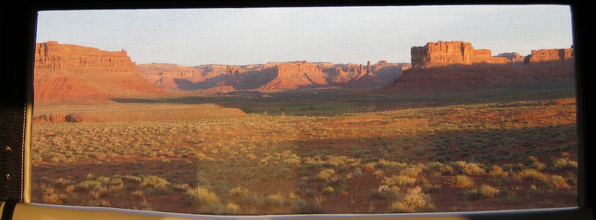
The next day, October 1, it was time to clean up around the dumpsters (the bears didn't eat cucumber peelings - interesting), break camp and head for home. But, I heeded Argonaut20's advice and took a detour on the road to Elk Mountain. It's a long drive on a dirt road that was mostly in good shape, but the recent rains created some deep puddles. Still, it was two-wheel drive until near the end of the road. The Elk Mountain summit is 11,400 feet and provides some great views.

Looking east from the summit

Looking northwest - toward the Pecos Wilderness.

Looking south at the aspens showing some color. An old fire came right up to the summit.

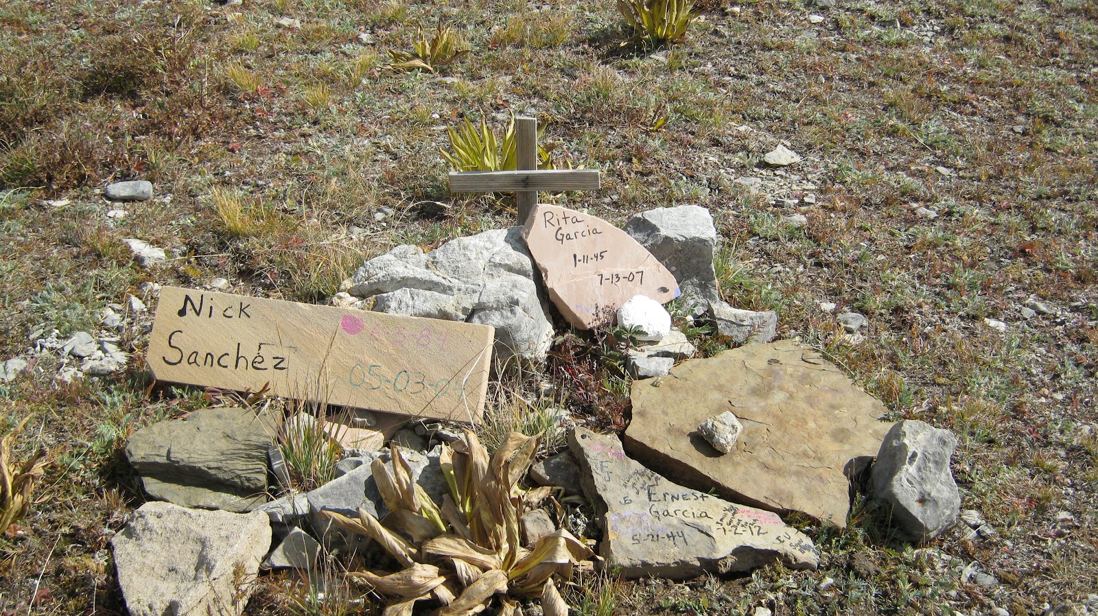
Hey, Argo, do you know anything about this memorial at the summit?

Then, it was time to head south out of the Pecos Canyon, down through Encino, Corona, Tularosa, Carrizozo and Cloudcroft to home. It was a great, relaxing trip and I left plenty of other trails to explore.

Sunday, September 16, 2012

Hiking in My Backyard

Katie the collie and I went hiking today with a neighbor and her dogs. We went just down the road from where we all live to a trail in the Lincoln National Forest. While hiking we had some visitors.


I knew there were wild horses wandering the Lincoln NF, but this is the first I've seen them so close to where I live. Cool.

Thursday, September 13, 2012

Retreaded!

On September 1, 2012, I officially retired, but I prefer to think of it as being retreaded. To launch my new life among the idle poor, my sister came to visit for a month, and toward the end of her visit and at the start of my retreadment, we headed out for a one week wander around New Mexico, Arizona and Utah.

I had in mind checking out a few fishing spots, and then we would head into red rock country in the Navajo Nation and Utah. We started from my home in the Sacramento Mountains on September 3, and headed toward Arizona. Because we got a late start, we stopped for the night in a good free boondocking spot that I know of. This place is no secret - it is Jackson Park in Pie Town, NM. What's nice about this spot is that after a good night's sleep, you are in walking distance of breakfast at the The Good Pie Cafe (formerly the world famous Daily Pie Cafe).

Our campsite in Jackson Park

There was a population explosion of black woolly caterpillars here. If you didn't watch where you were walking, you would cause a caterpillar catastrophe.

Another view of Jackson Park


When we went to the Good Pie for breakfast in the morning, there were two loaded touring bicycles parked out front. Inside were a couple who had traveled on those bikes from Banff. Their destination was Silver City, so they were almost done with their trip. I think they said they had been on the road for ten weeks. Since Pie Town is near the Continental Divide Trail as well as the road bike trail that stays close to the CDT, it's not rare to see through-hikers and cyclists enjoying a good meal at the cafe.

After stuffing ours bellies, we made the short trip to Big Lake near the White Mountains of Arizona. I wanted to visit it because of an article I had read in a fly fishing magazine. There are several campgrounds at Big Lake, all run by a USFS contractor. Everything from full hookups to walk-in tent sites are available, but don't expect seclusion.

Our campsite was on a squirrel highway, which kept Katie the collie entertained.

We had a campsite without hookups, and with my new geezer card it was a good value. Showers are free (at least in the Apache Trout CG), so keep the camp in mind if you've been at a dispersed NF campsite for a while and want a hot shower without worrying about running out of water.

Here's a view of Big Lake. We saw plenty of opportunities nearby in the Apache NF for dispersed camping. The area is at the edge of where the 2011 Wallow fire burned. There was plenty of evidence of low intensity fire here, but this particular area will recover quickly. You can sort of see some burned areas in the hills behind the lake.

I tried fly fishing from the shore in a nearby cove, but had no luck, since the wind was high and my casts didn't go very far. Fishing from a boat would be the way to go on Big Lake. You can rent boats at the marina store (both powered and rowboats). Rowboats go for approximately $35/per day. Power boats are closer to $100 per day. Float tubes would be good in the coves.

Very close to Big Lake is Crescent Lake. Sorry - no pictures. It is smaller than Big Lake and would be an excellent place to take a float tube. Wading out from the shore at Crescent Lake I made a few casts with a woolly worm and felt a bump but didn't set the hook - dang! Then the thunderstorms started. Thwarted again. There are supposedly brookies, cutthroats and even apache trout in these lakes. I will come back here, but will make sure to bring the float tube, and will wait for the monsoon season to wind down.

After two days at Big Lake we headed north to the Navajo Nation. We had plans to go to Monument Valley the next day. There used to be a campground in Monument Valley (Mitten View CG). That site now has a big hotel on it, and the relocated Mitten View CG was still under construction and closed. We ended up at a hotel in Kayenta. Expensive! But, less expensive than the aforementioned View Hotel in Monument Valley.

In the morning, we took the driving tour of Monument Valley. There are vendors all along the route hawking stuff that looks to be mostly made in China, but I guess I can't blame the Navajo for trying to separate tourists from their dollars - tourism is a major source of income after all. The geologic features are worth taking the time to drive around. For added ambience, I recommend tuning in KTNN (The Voice of the Navajo Nation) at AM 660.

The classic view of the Mittens and Merrick Butte.

The Dancers emerging from their hogan (Yei Bi Chei) and the Totem Pole.


The view from Artist's Point. I could see John Ford directing a movie scene in my mind's eye.

The day was only half gone, so we decided to make some progress toward our next destination. We headed into Utah and sunset found us at Hite crossing on Lake Powell/Glen Canyon. This is a moderately scenic place, but mainly was just a convenient stopping spot. Here's the view from near where we camped.

After breaking camp in the morning, we continued on our way to Capitol Reef NP. Shortly after crossing Lake Powell by the bridge, we stopped at the Hite overlook. We were looking down on where we had just camped. Lake Powell is so low that treetops from the flooded Hite City were showing, and a wall of rock that I think was part of the town was above the water.

We reached Capitol Reef NP in time to buy an apple pie for lunch (not healthy, I know, but delicious) at the old Gifford house, now a museum and store. This was right after we grabbed a campsite in the Fruita CG. Even on a weekday after Labor Day it fills up, so getting a site early was a priority. The campground and visitor center are all in the now abandoned Mormon townsite of Fruita and the NPS is nurturing and replanting the orchards that were planted there. My pie was made with local apples. A lot of the trees are heirloom varieties. You can sample fruit for free in designated orchards, which is where my breakfast came from the next day.  The settlement was very remote and some of the residents were LDS in name only - the town didn't even have a church, but apparently had some stills. There were never more than 8 or 10 self-sufficient families living there, and Butch Cassidy reportedly hid from the law in the area.

Since we were traveling with dogs, hiking in Capitol Reef was out (no dogs on the trails) and we had to be content with the scenic drives in the park. Here are some views of the different types of sandstone formations along the scenic drive that goes along the Waterpocket fold, a 100 mile long monocline.


And some of the petroglyphs in the park. Unfortunately these pics were taken when the sun was shining directly on the rock faces, so the contrast is low.


On the left side of the following picture is Navajo Dome. The Navajo sandstone weathers in more rounded forms. If I remember right, the Navajo sandstone is formed from primeval dune sand during a desert epoch, is not heavily cemented, and weathers with less fracturing than other more heavily cemented sandstones.

A distant view of Capitol Reef from the west end of the park.

Here are two closed off adits to the old Oyler uranium mine. This mine was active in the early 20th century when uranium was mainly used as a glass and glaze colorant. There are trace amounts of radium, too, which was one of the most valuable substances at the time, used mainly in medical cure-alls. There is still uranium in there and in some outcroppings in Grand Wash.

Along the Grand Wash road is a view of Cassidy arch.Look carefully in the top layer of the rock. See it?

Okay, here's a close-up. Supposedly, Butch Cassidy hid from the law here.

My sister's path and mine diverged at Capitol Reef. She headed back to N. California and I turned back toward home in New Mexico. I passed by both the dirt road that goes down the Waterpocket Fold and the turnoff to Goblin Valley. Obviously I need to come back to take those roads! Instead, I had read about the Moki Dugway on Wander the West, so went that way.

Looking down at the Valley of the Gods B & B from the Moki Dugway viewpoint.

It was a no-brainer decision to camp for the night in Valley of the Gods.

Sunset from my campsite. The only problem with camping at one of the viewpoints is that people driving the loop road will pause near your camp to take pictures. That stops after sunset.

The view out my camper window while I was making morning coffee. Not a bad way to wake up.

A closer view in the morning light.

I broke camp and drove the dirt road loop through Valley of the Gods. It's an easy road, but crosses many washes and could be trouble in wet weather. It hadn't rained here recently, though, so it was pretty smooth going.

I had planned to head for Coyote Creek campground in New Mexico that day, but because of touring Valley of the Gods I got a late start and stopped instead at Hopewell Lake CG in the San Juans west of Taos. It was my first time there. Hopewell Lake is actually a small reservoir and is stocked with brook trout. Another place to visit again with my float tube. While walking the shoreline the next morning, I saw two male brookies in full spawning colors fighting each other in the shallows. Before I could get the camera out, they had moved their fight elsewhere. Dang.

I would have liked to stay and fish, but it was a long drive home and I was due back, so I reluctantly packed up and hit the road. I hope to come back to Hopewell Lake when I make my next trip to the Rio de los Pinos at the New Mexico / Colorado border.  Now that I'm retreaded, those opportunities should be more frequent.

Thanks for following along on my first retreadment trip.